Lotea
Field-to-shelf traceability for a co-op in the Campo de Cartagena.
- Client
- Concept project
- Category
- Platform
- Services
- Platform, Maps, Traceability, Dashboards
- Year
- 2026
Concept project: the client and their data are fictional; the design, the code and the demo are ours and live.
The brief
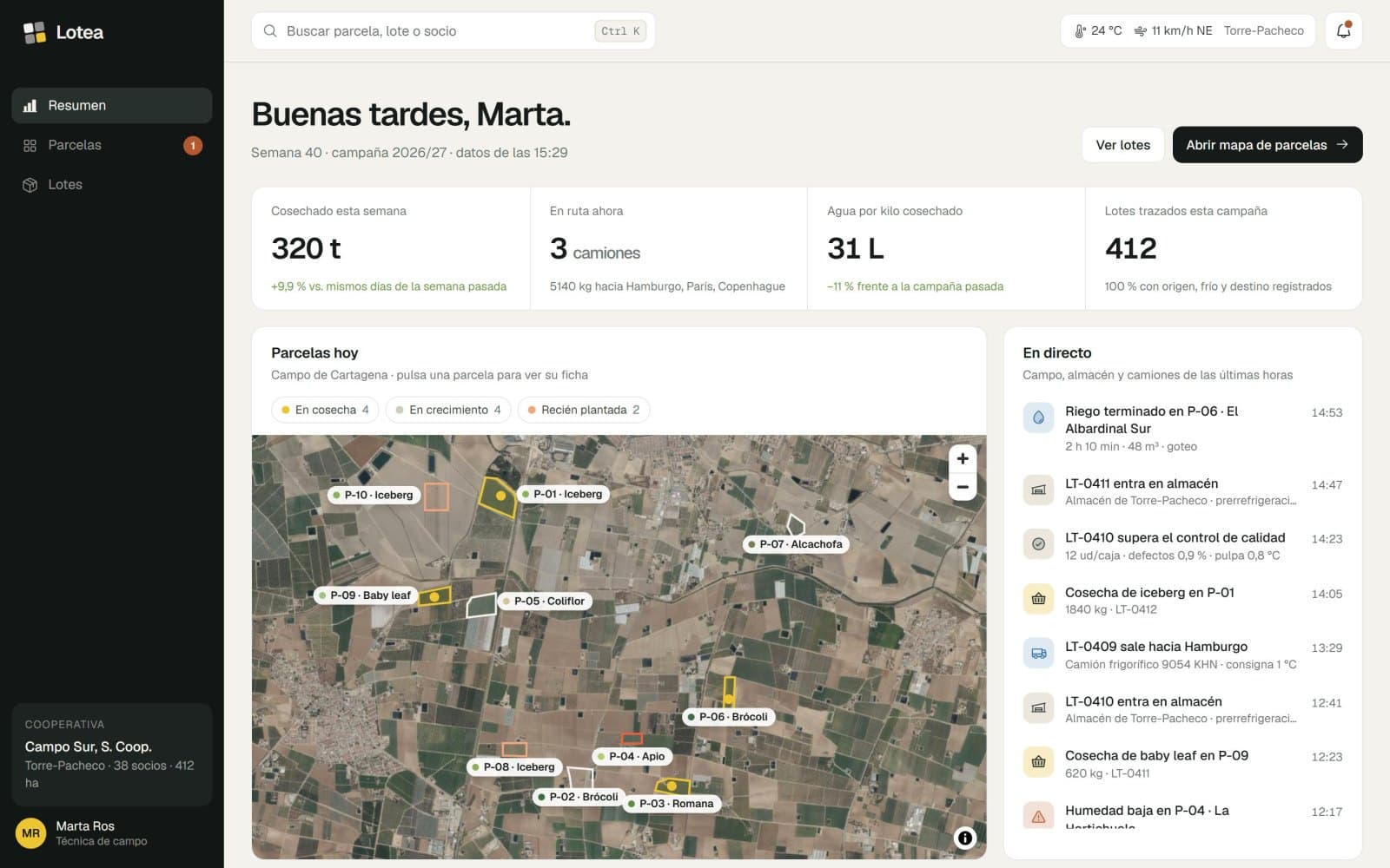
We started from a fruit and vegetable co-op in Torre-Pacheco that exports lettuce, broccoli and celery to Europe. Its buyers want to know which field every box comes from and how it travelled; its team wants to see at a glance what is being harvested, watered and shipped today.
What it does
- 01
Plot map
Every plot drawn on the aerial photo, with crop, grower, soil moisture and days to harvest.
- 02
Harvest and irrigation, up to date
Charts of tonnes per week, water per plot and a flow from every field to every country.
- 03
Lots with a history
Each lot links plot, cutting date, cold store and truck, with its route on the map.
- 04
A QR on every box
The buyer scans it and sees which field it came from, who grew it and how it travelled, in Spanish, English or German.
Screens
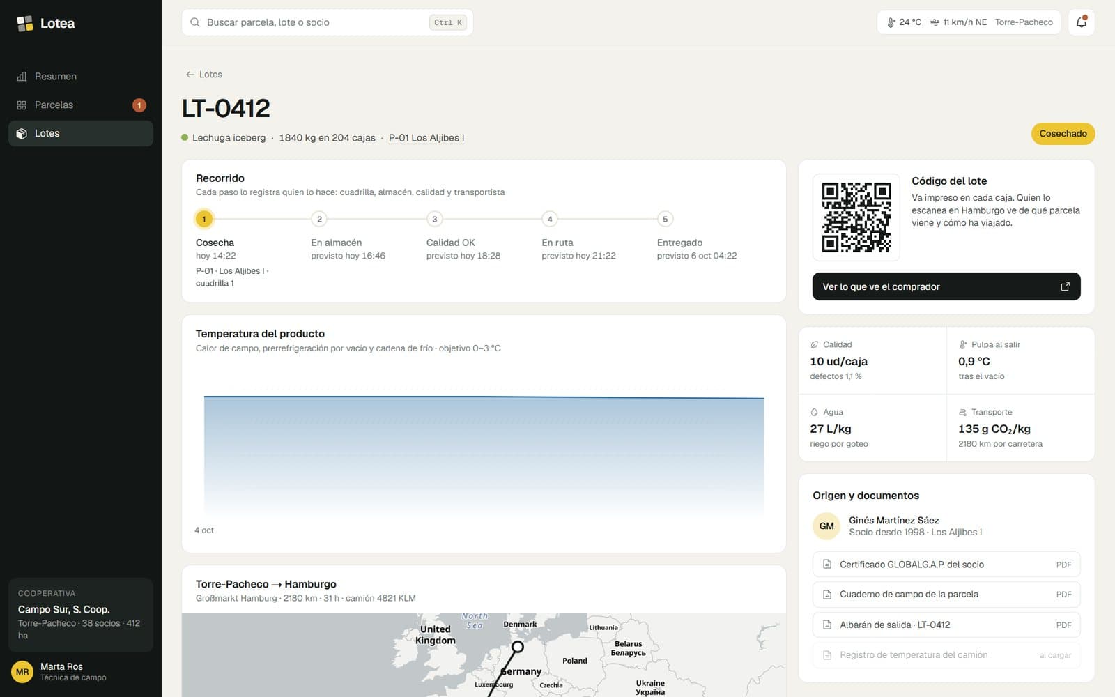
A lot's page: its journey, temperature, the QR on its boxes and the grower's documents.
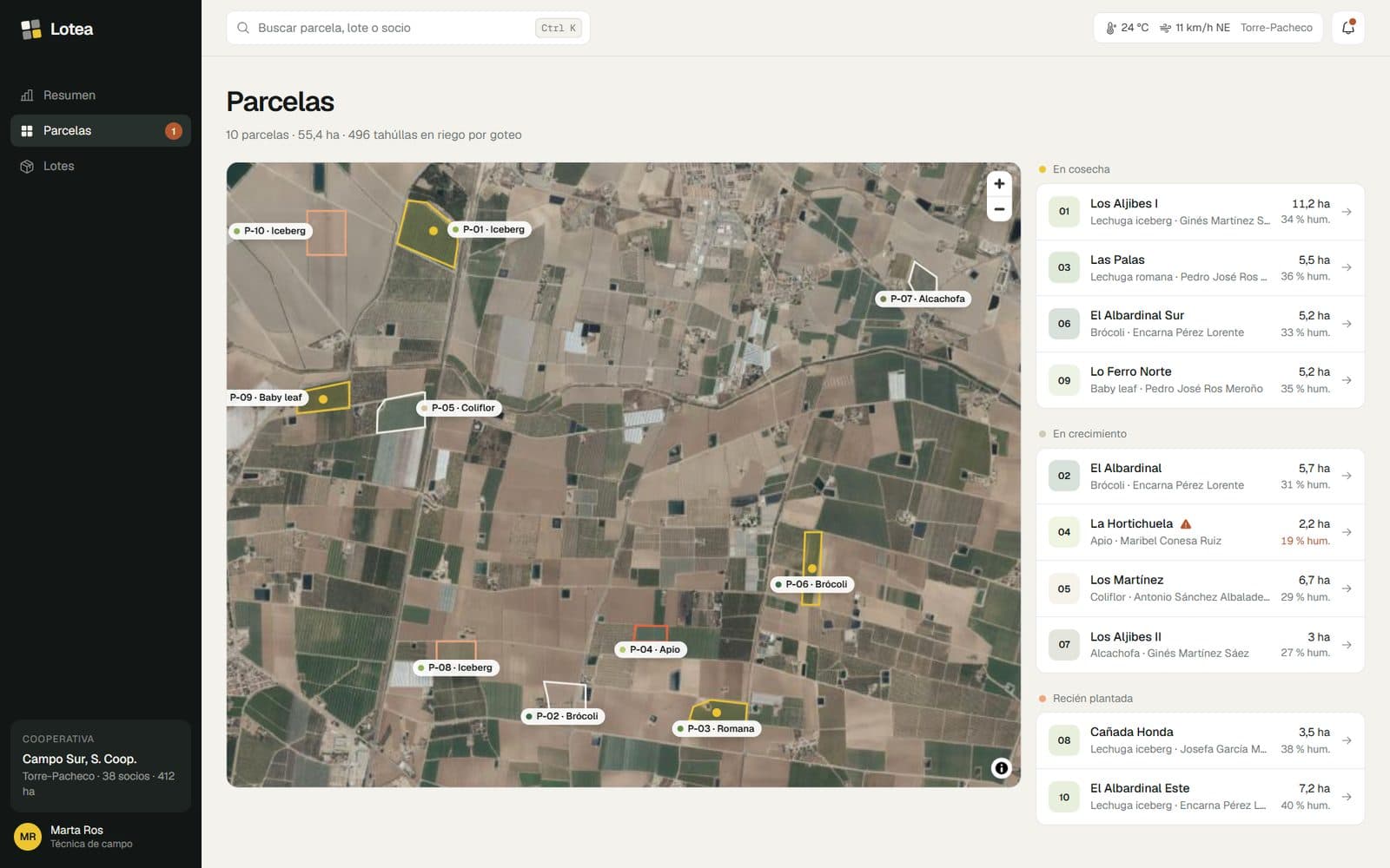
Real plots on the IGN aerial photo, with their status and probe.
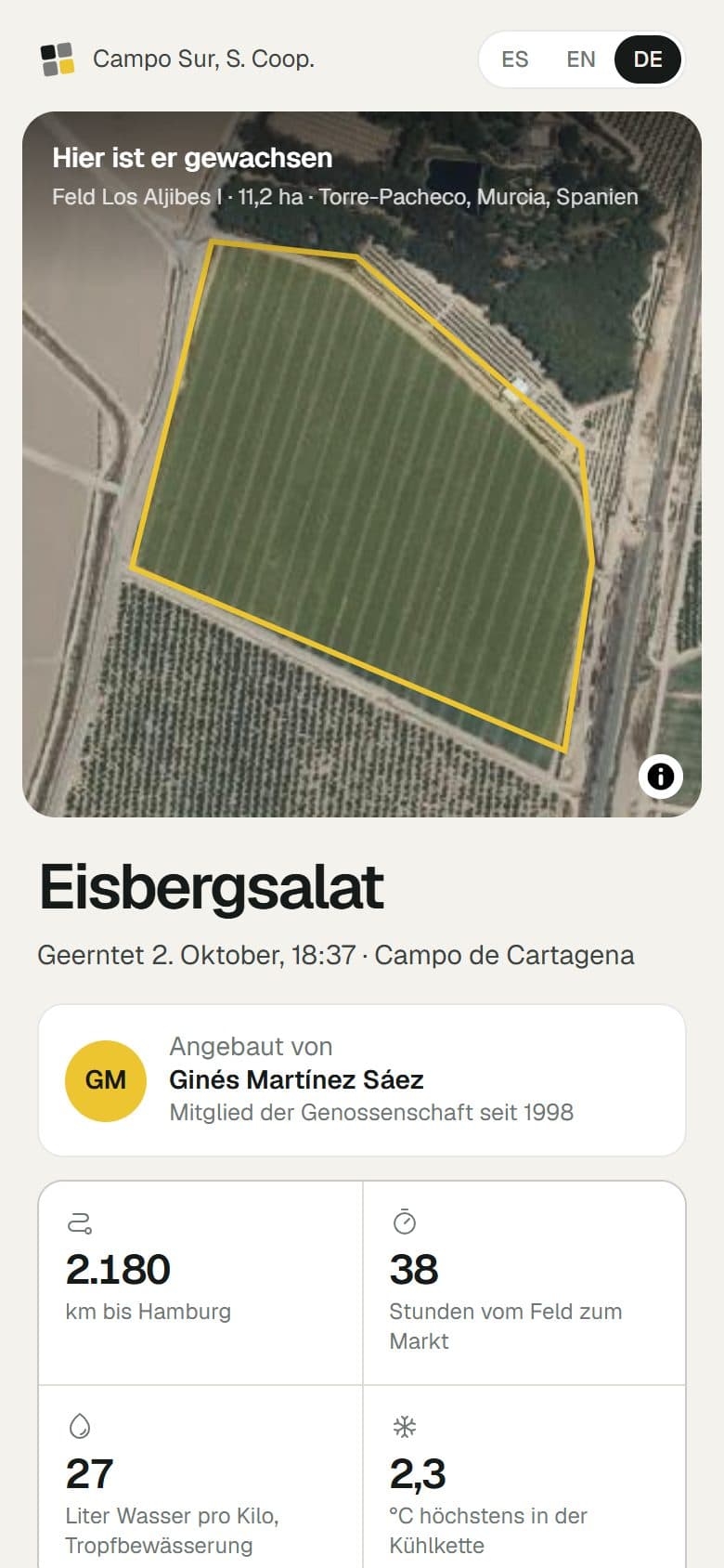
The QR page on every box, in the destination country's language.
How it is made
Real fields
The plots are traced by hand on the PNOA aerial photo from Spain's National Geographic Institute, the same layer the map shows.
Data you can read
Custom charts for harvest, irrigation and destinations, with dates and times in Madrid time.
Language by destination
The public page picks its language from the country the lot is going to, so buyers never have to look for it.
Built with
- Next.js
- MapLibre
- IGN PNOA
- Bklit
- Motion
- Kokonut UI
Something like this for your business?
A website, a platform, an app or an automation. Tell us what you need and you get a reply from a person within a day, with a first idea of how we would build it.